Contact
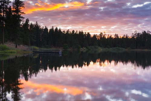 Sunset at Delintment Lake along Forest Service road NF 41 in the Blue Mountains. (Oregon State Archives Scenic Images collection)
About
Established: Feb. 25, 1889
Elev. at Burns: 4,118'
Area: 10,228 sq. mi.
Average Temp.: January 27.5° July 69.4°
Assessed Value: $721,585,507
Real Market Value: $1,221,251,865
(includes the value of non-taxed properties)
Annual Precipitation: 10.13"
Economy: Forest products, manufacturing, livestock and agriculture
Related Resources
Historical Records Inventory
Harney County Scenic Images
"County QuickFacts" (population and economic data from U.S. Census Bureau-enter county name)
County Seat Map (from Google Maps)
County Map (from ODOT)
Incorporated Cities
Points of Interest
Steens Mountain, Malheur National Wildlife Refuge, Alvord Desert, Alvord Hot Springs, Eastern Oregon Agricultural Research Center, “P” Ranch Round Barn, Frenchglen, Wild Horse Corrals, Delintment Lake, Yellowjacket Lake, Burns Paiute Indian Reservation
History and General Information
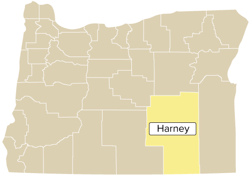
Harney County was carved out of Grant County and named for Major General William S. Harney. At 10,226 square miles, it is the largest county in Oregon by land mass and one of the largest in the United States. Burns and Hines are the only incorporated cities in Harney County. The Burns Paiute Indian Reservation is also within the county and immediately north of Burns. The town of Burns established its first newspaper in 1884 and its first church in 1887. The Harney County Courthouse was constructed in 1895.
Harney County shares the largest ponderosa pine forest in the nation with Grant County and has more than 100,000 beef cattle on its vast ranges. Its abundance of game, campsites, and excellent fishing and bird-watching have stimulated fast-growing recreational activities.
County Officials
County Court: Judge Bill Hart (2027); Patty Dorroh (2027), Rob Frank (2029); Dist. Atty. Ryan Hughes (2029); Assess. Corey Hill (2029); Clerk Derrin (Dag) Robinson (2029); Justice of the Peace Riley Richardson (2031); Sheriff Dan Jenkins (2029); Surv. Kenny Delano; Treas. Bobbi Jo Heany (2027)