Protecting a Rare and Special Place
John Day Fossil Beds National Monument is in Wheeler and Grant Counties in north-central Oregon, at the western end of the Blue Mountains. Established by Congress in 1974, the monument covers 14,062 acres. It is managed by the National Park Service and is arranged into three administrative units: Clarno, Painted Hills, and Sheep Rock. These units were each set aside to protect one of the world’s most complete, diverse, and well-preserved fossil records of Cenozoic land-based plants and animals. The fossils, combined with their relative stratigraphic positions within many well-dated volcanic units, offer a rare opportunity to unravel a very precise history of regional volcanic activity, changing landscapes, climate fluctuations, and evolving plant and animal life.
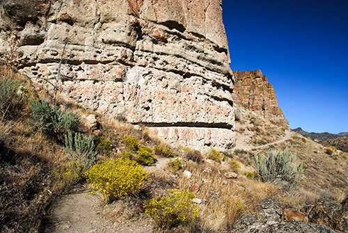
Rocks and fossils found in the John Day Basin have been the focus of geologic investigations for 160 years, starting with those led by Dr. Thomas Condon. Visitors to the John Day Fossil Beds National Monument today experience a journey through time, where the rocks and fossils provide details about how life evolved in this area over the past 45 million years. The monument challenges visitors to imagine the landscape of eastern Oregon as it was millions of years ago, when palm trees grew, sheep-like oreodonts and rhinos roamed, and volcanic eruptions periodically devastated the landscape and its ecosystems. Much of this story is told through detailed exhibits, educational programs, and ongoing scientific research at the Thomas Condon Paleontology Center in the Sheep Rock unit. The natural marvels of the park can also be experienced simply by taking a walk. By doing so visitors will find evidence of 45- to 7-million-year- old landscapes shaped and reshaped by volcanic activity and climatic fluctuations. From oldest to youngest, this history is preserved within the rocks of the Clarno and John Day formations, Columbia River Basalt and the Mascall and Rattlesnake formations. All units of the monument have short and easy interpretive trails to more challenging adventures that pass by fossil-rich areas or allow access to multicolored hillsides, castle-like cliffs, and deep canyons.
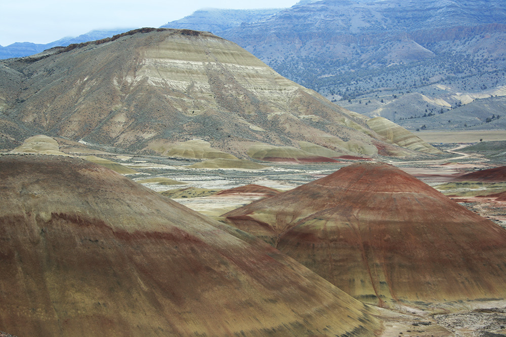 Bedded ancient soils and tuffs below Carroll Rim in the Painted Hills Unit of the John Day Fossil Beds National Monument. Carroll Rim, itself, is the 28.7-million-year-old Picture Gorge ash flow tuff. View is looking northeast. Photo Credit Jason McClaughry, DOGAMI, 2009. Open image in larger view
A Volcanic Timeline
The time between 45 and 25 million years ago, when the Clarno and John Day formations were deposited, corresponds with a time when volcanic fields expanded across the Blue Mountains. Within these volcanic fields, broad shield volcanoes, smaller domes and dome fields, and larger eruptive centers such as the 40-milion-year-old Wildcat Mountain, 32-milion-year-old Tower Mountain, and 29.5-milion-year-old Crooked River calderas grew. The great volumes of volcanic ash erupted from the calderas sped along in hot ash clouds that hugged the landscape or fell as ash-falls that blanketed the terrain. One of these is the 28.7-million-year-old Picture Gorge ash flow that likely erupted from the Crooked River caldera. The remnant of this ash flow now forms prominent ledges that are a distinctive part of the John Day Formation in the monument. Located between and draining these volcanic fields, were broad basins that accumulated lava flows, volcanic mudflows, thick layers of ash, and stream, lake, and marsh deposits of the Clarno and John Day formations. Fossils within the John Day Fossil Beds are often preserved in fine-grained sedimentary rocks produced from the weathering and erosion of volcanic materials.
Ash-derived sediment within the Clarno and John Day formations locally entombed and spectacularly preserved an array of ancient soils and now-extinct animals and plants as fossils. Many fossils have been found in the approximately 29-million-year-old Turtle Cove Member of the John Day Formation. Fossils found of now-extinct mammals include fragments of mouse-deer, sheep-like oreodonts, rhinoceros, and giant, hog-like entelodonts. Together, these soils and fossils indicate a very wet subtropical greenhouse-like climate between 45 and 33 million years ago. Fossil evidence after 33 million years ago indicates there was a dramatic shift in climate to cooler and drier conditions. Wooded areas became like today’s eastern United States. Deciduous forests grew in the lowlands and coniferous forests grew at higher elevations.
Starting around 17 million years ago the relatively fluid lava flows of the Picture Gorge Basalt flooded the older volcanic landscape developed on the Clarno and John Day formations. These lava flows are part of the Columbia River Basalt Group and erupted from a series of fissures east of Sheep Rock. South of Sheep Rock, the Picture Gorge Basalt is buried by ash-rich sedimentary rocks and tuff of the Mascall and Rattlesnake formations. Between 16 and 13 million years ago fine- grained tuff, siltstone, and ancient soils of the Mascall Formation accumulated in low-gradient rivers, lakes, and marshes. Volcanic ash erupted at this time from several volcanic sources across southeast Oregon, including the Castle Rock and Ironside Mountain calderas. Ancient soils and an array of plant and animal fossils in the Mascall Formation suggest a humid and temperate climate with open grasslands and forested areas. Mastodons, horses, camels, rabbits, burrowing ground squirrels, and gophers, roamed these areas. The Rattlesnake Formation is the youngest geologic unit in the monument, including sedimentary rocks deposited in river and alluvial fan environments. It also includes the 7-million-year-old Rattlesnake Tuff, a large ash flow erupted from a caldera near Burns in southeast Oregon.
Next:
Oregon Caves National Monument and Preserve >