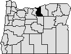
The Legislative Assembly created Gilliam County Feb. 25, 1885 from the eastern third of Wasco County. Residents argued they were too far from the county seat in The Dalles. In 1899 part of southern Gilliam County was used to form Wheeler County. Gilliam County is bordered today by the Columbia River to the north, Wasco and Sherman Counties to the west, Morrow and Grant Counties to the east, and Wheeler County to the south. Gilliam County's area is 1,223 square miles. It was named after Colonel Cornelius Gilliam who died accidentally while commanding the Oregon volunteers during the Cayuse War of 1847.
When the Legislative Assembly created Gilliam County, Alkali (now Arlington) was selected as the temporary county seat. The question of a permanent county seat was placed on general election ballots in 1886, 1888, and again in 1890 when Condon was finally chosen. Condon, which was incorporated in 1893, was originally known as Summit Springs. In 1884 the community took the name of a young lawyer from Alkali, Harvey C. Condon, nephew of the state geologist and university professor Thomas Condon.
Once the question of the location of the county seat was settled, voters in Gilliam County proved reluctant to provide a courthouse in Condon. After the county seat moved to Condon in 1890, county government operated out of a two-room house until 1903 when the county court appropriated money to construct a courthouse. This structure was destroyed by a fire in 1954 that caused heavy losses to the contents of the building, including many county records. The next year, the county replaced the burned structure with the present courthouse built on the same site.
Gilliam County has a county court form of government. Elected officials include two county commissioners, a county judge, district attorney, assessor, clerk, sheriff, surveyor, justice of the peace, and treasurer.
The county's population dropped sharply from a high of 3,960 residents in 1920 to 1,717 in 1990. After a significant increase in the 1990s, the 2013 population of 1,945 represented a 4% increase from 2010.
For many years, Indians traversed the county on well-worn trails to reach fishing, hunting, foraging and trading areas. Many of these trails are still visible in the rangeland. The first non-native people in the area included Americans following the Oregon Trail to the Willamette Valley. In the late 19th century, new settlers arrived from the midwestern and eastern United States and Europe. Many settlers were part of the larger reverse migration of people who had settled in the Willamette Valley.
Gilliam County is in the heart of the Columbia Basin wheat area. Its economy is based primarily on agriculture centering on wheat, barley and beef cattle. Apples and other irrigated crops are an important part of the economy of the north end of the county. After agriculture and livestock, other principal industries include tourism, waste management, hunting and fishing. Wind turbine farms have become a significant presence on the county's landscape as well.